Climate adaptation
A sea-level adaptation strategy for Hull
Climate Adaptation · Strategic Masterplanning · Blue-Green Infrastructure · Evidence-informed Design
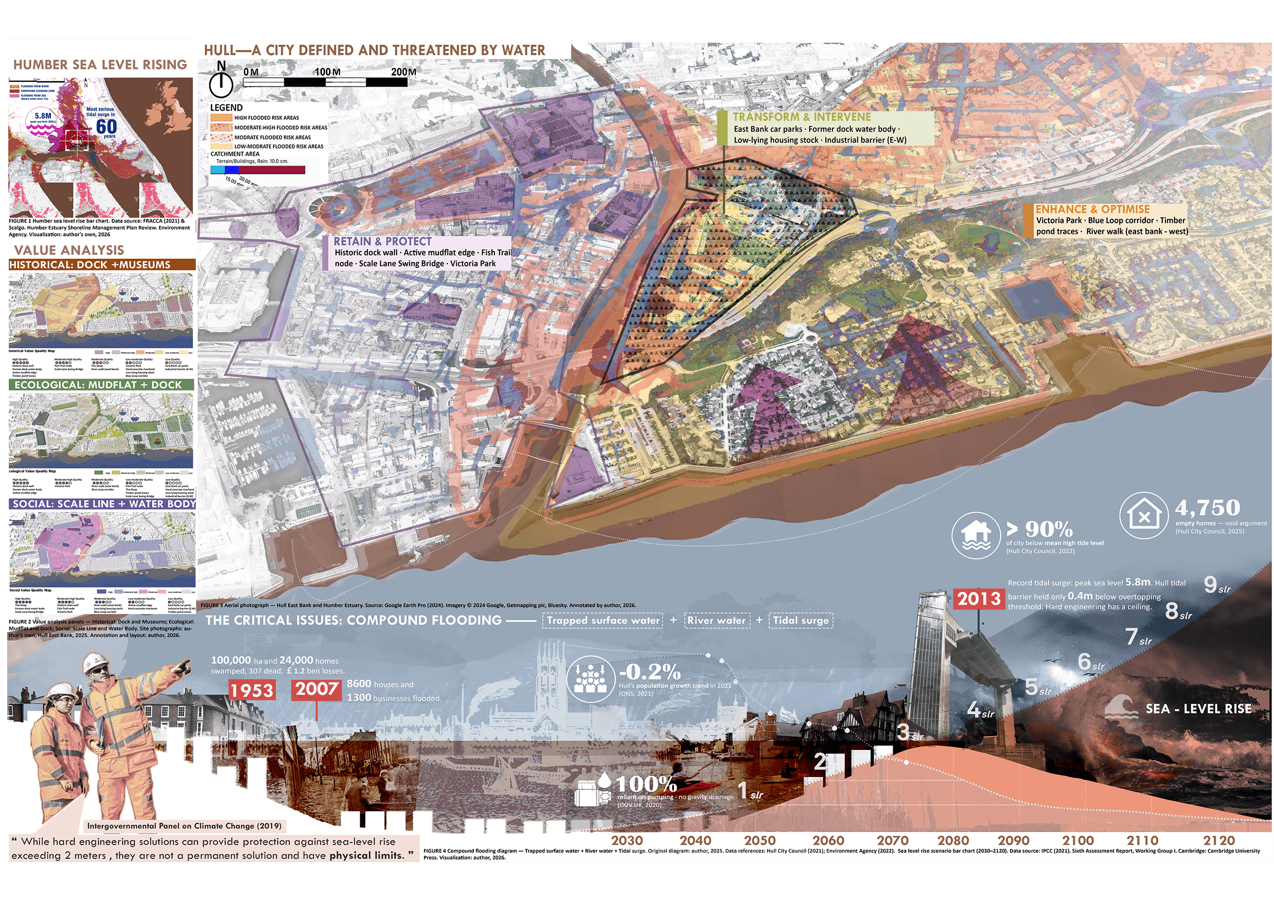
After London, Hull is the most flood-vulnerable city in the UK. Over 90% of the city sits below the level of the sea at high tide. It faces compound flooding: trapped surface water, river water, and tidal surge simultaneously. People just built higher and higher walls; when water came in, they trapped themselves in the concrete bowl, and the city disappeared.
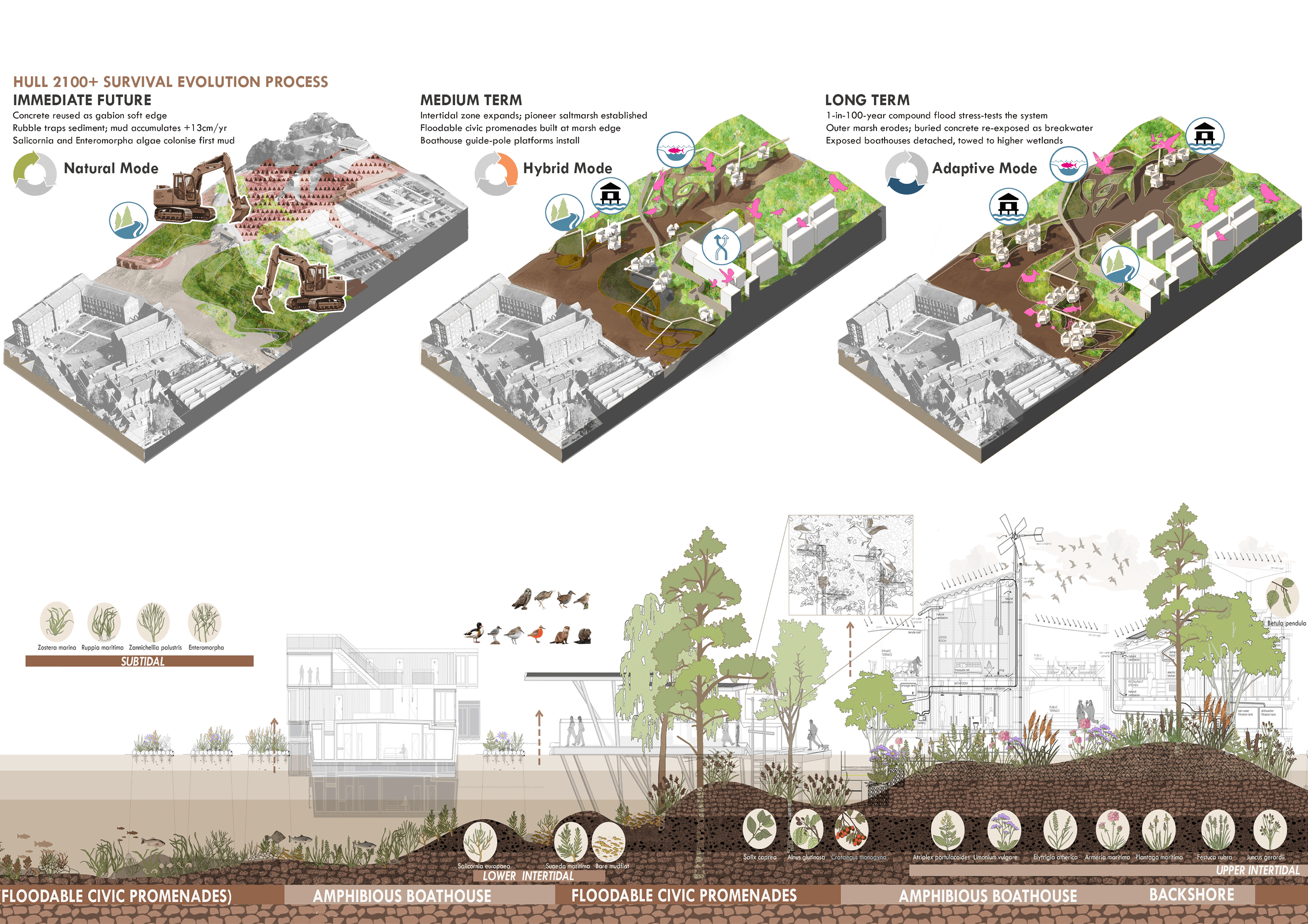
The vision for the project is to create an estuarine entrance that provides a living environment sharing tidal rhythms and ecological and civic lives, moving away from the focus on the flood danger to welcome a breathing, changeable landscape.
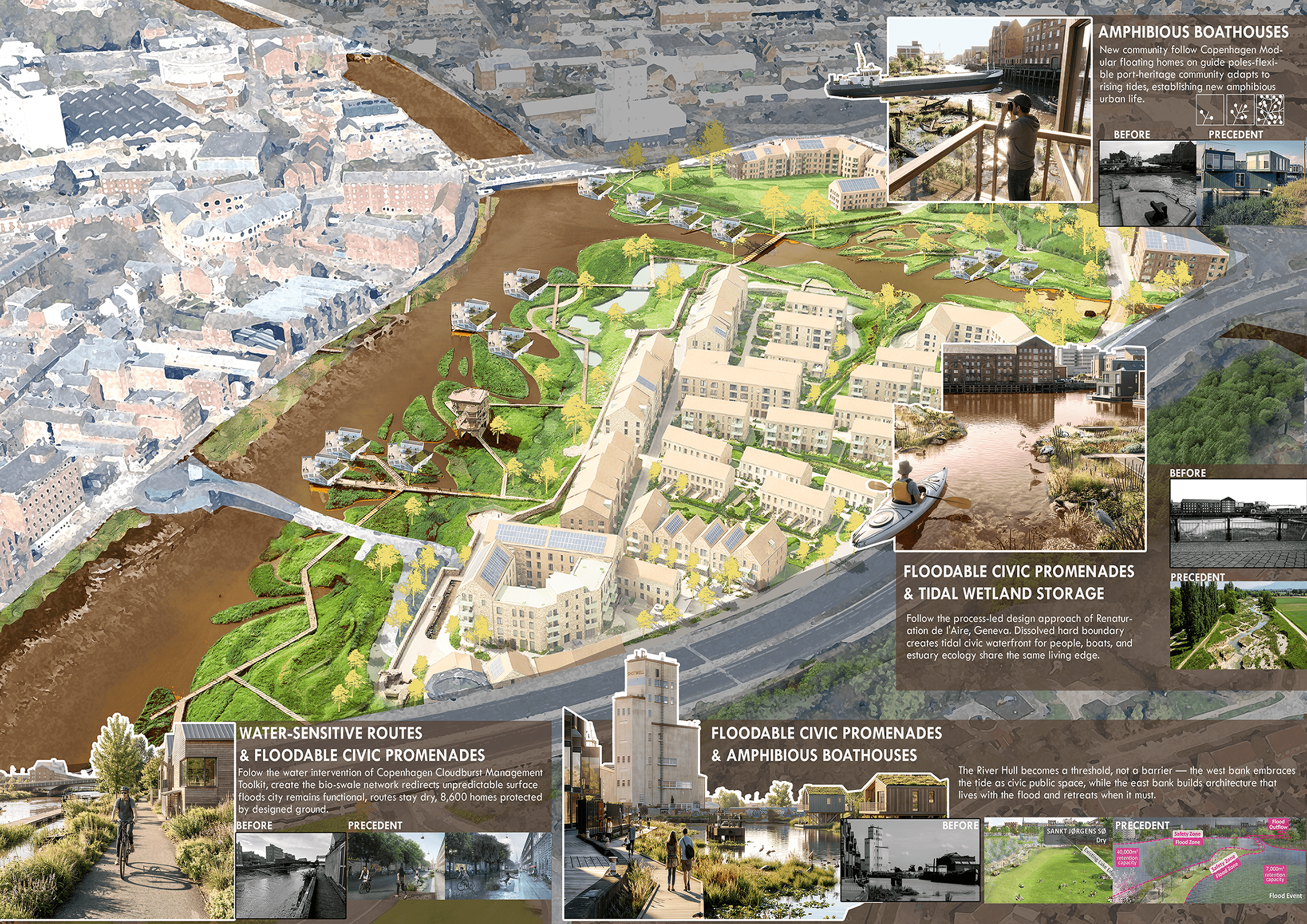
The proposed interconnected water system makes space for the seawater intrusion and allows for a more resilient living environment.
Fluidity is privileged above rigidity, the strong identity of the River Hull is respected, and changes over time are celebrated.

Challenge
What if water is a partner, not an enemy? How can coastal infrastructure become an adaptive landscape that evolves with rising sea levels while supporting everyday urban life?
The city faces challenges including compound flooding (tidal surge, river water, and surface water), ecological degradation, missing the maritime heritage, and grey infrastructure limitation.


Aims
Develop a long-term climate adaptation strategy that integrates flood resilience, biodiversity enhancement, and public space into a single landscape framework.
Strategic framework
Make Space for Water, Rather Than Resisting It.
Following the historical docks network map to restore blue-green infrastructure, reconnect people to water, and summarize 4 design principles to create four different toolkits: Tidal wetlands, floodable civic promenade, amphibious boathouses, and water-sensitive routes. These principles were all learned from Rotterdam's previous practice to make Hull as Rotterdam successor in the UK. In the past the city was shaped by water. In the future they can still live with water and take a breath.
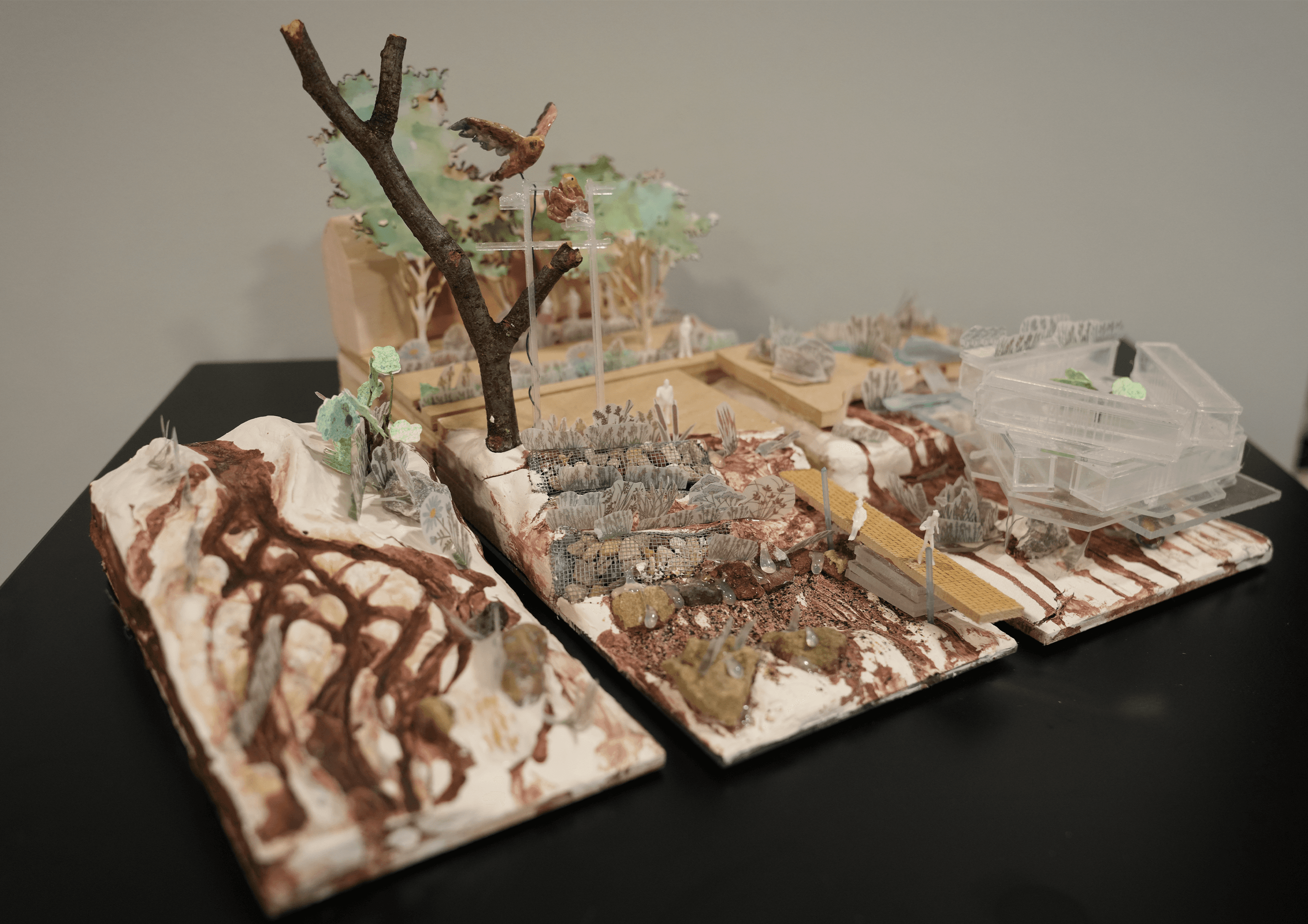
Handmade model: https://www.instagram.com/reel/DZfGrJ5CGZ4/?igsh=bm1nOXoxdzNxMWk1
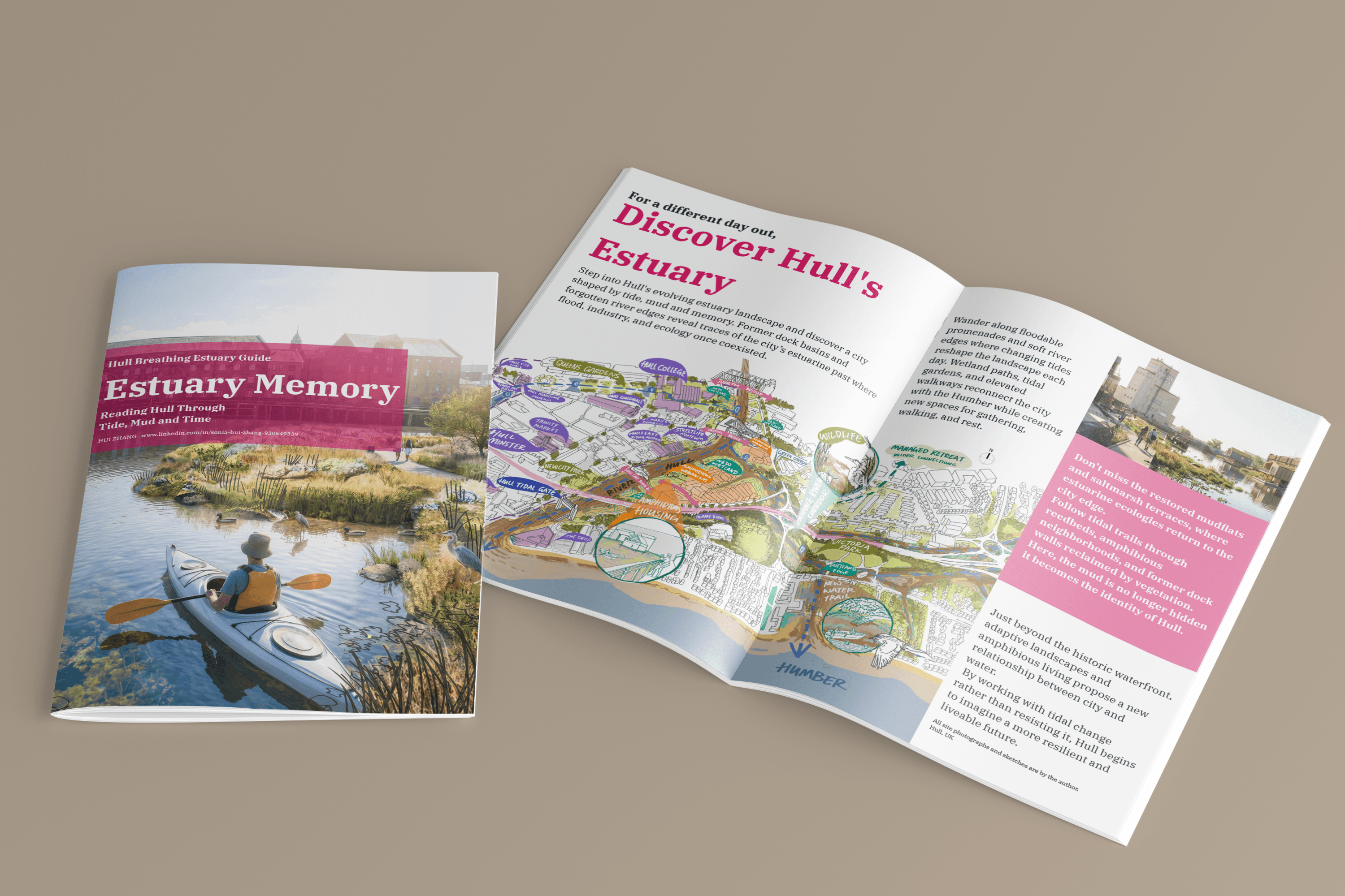
the Estuary Memory Guide booklet. If you'd like a copy of the PDF for review, feel free to email me directly at sonia71105791@gmail.com.
Outcome
Strategic masterplan
Climate adaptation framework
Four design principles
Integrated flood toolkit
Demonstrated evidence-based planning using QGIS and spatial analysis